Wurmberg summit route


- 3:30 h
- 11.98 km
- 434 m
- 434 m
- 565 m
- 955 m
- 390 m
- Start: Wurmberg cable car parking lot
- Destination: Wurmberg cable car parking lot
Bubbling mountain stream, rocky ascents, historic insights, great views – that's the Wurmberg adventure. Experience the Harz nature on this day trip – mountain hiking in a completely different way.
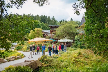
For a rest, the Wurmberg Alm or the Slow Food forest restaurant Rodelhaus are recommended.

Good to know
Pavements
Best to visit
Directions
Follow the symbol of hike 10 from the parking lot at the valley station of the Wurmberg cable car along the Warme Bode. The path leads you past the Lower and Upper Bode Waterfalls and through parts of the Harz National Park. You pass the Brockenstein, the shelter at the Stieglitzecke, and the reservoir before you reach the Wurmberg summit. From here, on a clear day, you have an especially beautiful view of the Brocken and the surroundings.
You begin the descent from the Wurmberg heading towards Großer Winterberg. On the saddle between Wurmberg and Großer Winterberg, you walk a part on the Harzer Grenzweg, which runs along the former inner-German border. At the level of the Hexenritt parking lot, you leave the Harzer Grenzweg and continue following the signage of route 10. The path leads you past the mid-station of the Wurmberg cable car back to the starting point.
Directions & Parking facilities
B 4 turnoff B 27 to the center of Braunlage
Wurmberg cable car parking lot, GPS: 32 U 611347 5732377
Bus stops: Herzog-Wilhelm-Straße or Trinitatiskirche
Bus connections: 820, 257, 470
Additional information
Author
Nicole Nutzeblum
Organization
Harz: Magische Gebirgswelt
License (master data)
Author´s Tip / Recommendation of the author
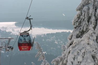
The family option: Relaxed ascent with the Wurmberg cable car. At the summit, you will find a children's playground and petting zoo. The descent to the Wurmberg cable car parking lot via the Hexenritt parking lot is 5.2 km. Along the Bode, the return route is about 7.5 km long.
For hikers with strollers: The almost 2 km long route from the Wurmberg cable car parking lot to the Rodelhaus forest restaurant is paved and easy to navigate.
The route can also be started from the Hexenritt parking lot. GPS: 32 U 612516 5734582
Nearby


Download GPX file