- 2:35 h
- 9.13 km
- 191 m
- 191 m
- 460 m
- 535 m
- 75 m
- Start: Tanne: Hiking meeting point at the corner of Lindenwarte/Schierker Weg
- Destination: Tanne: Hiking meeting point at the corner of Lindenwarte/Schierker Weg
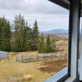
A worthwhile circular hiking route with great views, blooming and fragrant mountain meadows, and ideal to get to know the Harz village of Tanne.
With approximately 7 km or about 9 km including the detour to Kapitelsberg, it is an easily manageable half-day route without major exertion.
Since the circular hiking trail can also be shortened at any time via the village of Tanne, it is especially recommended for families with children (without strollers).
Good to know
Pavements
Best to visit
Directions
Follow the signs ► white sign with a cow's head in a red circle
The hiking trail leads you from the hiking meeting point in Tanne:
► along the Lindenwarte towards the hotels Tannenpark and waldhotel AUSZEIT
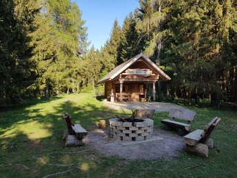
► past the natural log houses and the tennis court
► after about 450 m, turn right
► after a further 400 m you reach a forest edge (Brocken view), here keep to the right
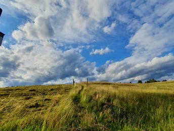
► continue hiking along the mountain meadows (partly on beautiful narrow paths) straight down into the valley of the Warme Bode.
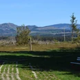
► enchanting (wide) views over mountain meadows and the Red Harz upland cattle accompany the hiker
► at the forest car park (L98) turn right and after about 1 km you reach the village of Tanne
► at the carpentry, cross the L 98 (Tanne-Königshütte) and turn left
► after a few meters along the street, you reach the green steel bridge (Hermann von Frankenberg Bridge) – cross this......
NOTE:
At this point you reach the fork in the path, the detour to Kapitelsberg (see description 2* below)
... Do you decide on the Harz Highlands Cattle Trail?
Then continue as follows:
► After crossing the bridge, keep sharply to the right and follow the signs for the Harz Highlands Cattle Trail.
► The path now runs along the southern side of the valley to the B242 (car park at the forest road).
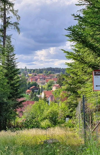
► Numerous viewpoints with views over and of the Harz village Tanne invite you to linger.
► On reaching the B242, cross the road and follow the further path (Ziegenberg and Jägerborn).
► You reach the village of Tanne – there you pass the Jägerborn spring and the oldest house in Tanne.
► Arriving at Jägerbornstraße, turn left and follow the road to the Bode bridge.
► After crossing the Warme Bode again, continue to the main road, cross it and turn left into "Zinne".
► Over a narrow path, directly over a wonderful mountain meadow, it goes past the hotel waldhotel AUSZEIT to the starting point "hiking meeting point".
*Description 2 – Detour to Kapitelsberg (HWN 44)
► The ascent to Kapitelsberg with its 510 meters of elevation is worthwhile (round trip approx. 2 km):
► a fascinating view of Tanne and the Brocken massif awaits you
► after crossing the green steel bridge (Hermann von Frankenberg Bridge), follow the left signposting "Kapitelsberg"
► the ascent leads through the forest and is somewhat steep
► after about 1 km at the top, the hiker is rewarded with a fantastic view
► DON'T FORGET: take your hiking pass!
► descend back to the valley or back onto the Harz Highlands Cattle Trail following the signposting "Tanne"
► back at the green steel bridge – you will see the familiar signs with the cow in the red circle and follow them straight ahead (do not cross the bridge again)
► please continue reading above ... Do you decide on the Harz Highlands Cattle Trail? Then continue as follows: ...
Equipment
Sturdy footwear, functional clothing, backpack provisions, sun and rain protection are recommended.
Remember to pack (mobile phone) camera, Harz Hiking Pin stamp booklet, and possibly binoculars.
Directions & Parking facilities
You can reach Tanne by car
- from Wernigerode via B244, turnoff Elbingerode B27, continue to turnoff Königshütte L98 towards Tanne
- from Braunlage via B242, heading to Tanne
- from Nordhausen via B4 to turnoff L98 Benneckenstein towards Tanne
Parking spaces are available in the village of Tanne.
You can reach the Harz village Tanne by bus of the Harzer Verkehrsbetriebe:
- from the direction of Wernigerode.
The INSA - your route planner for local transport in Saxony-Anhalt >>
TIP:
With the Harz Holiday Ticket you are mobile free of charge in the entire Harz district.
HATIX - the free use of public bus lines of Harzer Verkehrsbetriebe, Q-Bus local transport company, Halberstadt Transport Ltd., as well as the Südharz Transport Company in the Harz district. Now also free use in the districts of Goslar and Göttingen.
More information at: www.hatix.info
Additional information
Tourist Information Elend/Tanne/Sorge
Hauptstraße 19
38875 town of Oberharz am Brocken/OT Elend
Tel.: 039455/375
Literature
No literature is known.
Author
Mandy Leonhardt
Organization
Tourismusbetrieb der Stadt Oberharz am Brocken
License (master data)
Author´s Tip / Recommendation of the author
On this circular route you have the opportunity to collect one of the coveted stamps of the Harz Hiking Pin.
From here you have a fascinating panoramic view of Tanne, the Harz mountains, and the Brocken massif.
From spring to autumn, the Harz Red Highlands Cattle grazes in the valley of the Warme Bode below the Kapitelsberg. Many mountain villages, including the Harz village of Tanne, are committed to the preservation of the Harz Highlands Cattle.
The demonstration farm of the Brocken farmer Thielecke invites all hikers after the introductory tour around Tanne to get to know the farm and learn interesting facts about the breeding operation.
Safety guidelines
No safety notices are known.
On some route sections, short-term impairments, detours, and path closures can occur at any time due to forest changes and storm damage. Please inform yourself shortly before your hike.
Current notes can be found here >
Map
Hiking map - town of Oberharz am Brocken 1:25000; ISBN 978-3-86973-065-3
Nearby
