The big Harz route

- 10:30 h
- 199.72 km
- 2,284 m
- 2,285 m
- 196 m
- 826 m
- 630 m
- Start: Goslar - Kaiserpfalz parking lot (Kaiserbleek)
- Destination: Goslar - Kaiserpfalz parking lot (Kaiserbleek)
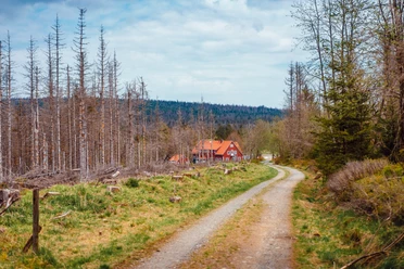
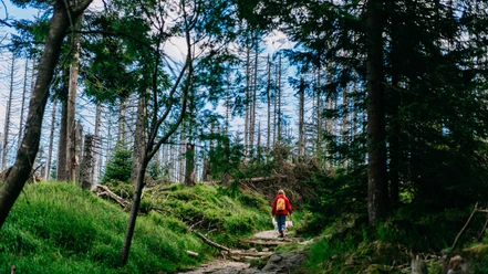
Goslar (starting point 1) -> Oker -> Oker Reservoir (shore path) -> Torfhaus -> Braunlage -> Elend -> Drei-Annen-Hohne -> Elbingerode -> Rübeland -> Rappbode Dam -> Hasselfelde -> Trautenstein -> Tanne -> Benneckenstein -> Hohegeiß -> Walkenried -> Bad Sachsa -> Osterhagen -> Bad Lauterberg (starting point 2) -> Silberhütte -> Sieber -> Herzberg -> Osterode -> Lerbach -> Clausthal-Zellerfeld -> Wildemann -> Lautenthal -> Langelsheim -> Astfeld -> Goslar (starting point 1)

Good to know
Best to visit
Directions
At the shooting house we turn right and follow the road, which becomes a paved forest path at the edge of the forest. In Oker, in front of the mineral water manufacturer's plant, the forest path meets the B498. We turn right and ride through the Oker valley to the Oker dam. Upon reaching the dam, we cross the dam wall and follow the paved shore path around the reservoir. In the third side arm, we veer slightly right into the so-called "Kalbetal". The following climb is very irregular and hides several unpleasant ramps with 10-16% gradients until we reach the B4, where we turn right and still have to overcome a 10% gradient up to Torfhaus. Having reached Torfhaus, we follow the relatively busy but wide B4 to Braunlage. In the town center, we turn left towards Elend. From Elend, we follow the signposts towards Wernigerode. In Drei-Annen-Hohne (a small station of the Harz narrow-gauge railway), we turn right and ride via Elbingerode to Rübeland. From there, the route continues over the Rappbode dam to the junction with the B81. Here we turn left and ride via Hasselfelde, Trautenstein to Tanne. In Tanne, we follow the signposts to Benneckenstein and Hohegeiß, losing a lot of altitude on the descent to Walkenried. After the descent, just follow the signposts to Bad Sachsa and Bad Lauterberg. Upon reaching Bad Lauterberg, we follow the main road right on the B27 and shortly afterwards turn left towards St. Andreasberg. At an inconspicuous intersection just before St. Andreasberg, we turn left to Sieber. With an average gradient of 5.4%, there is a climb of about 1 km up the Sieberberg, before descending through the Siebertal to Herzberg. In Herzberg, we follow the signposts to Osterode. At the roundabout in the center of Osterode, we follow right (first exit) the road through Freiheit, a short stretch over the B241, then right the junction to Lerbach. From Lerbach there is a climb with an average gradient of 4% along a low-traffic, winding road. The last kilometers must be covered on the less pleasant B241 to Clausthal-Zellerfeld. In Clausthal-Zellerfeld, we head towards Bad Grund and then turn into the Innerste valley towards Wildemann. We follow the Innerste valley, mostly downhill, passing Lautenthal and Innerste Reservoir to Langelsheim. Here we turn right via Astfeld following the signposts towards Goslar. From Astfeld, the bike path must be used because we run parallel to the B82 motorway. On arriving in Goslar, you reach the parking lot again via the signs "Altstadt" / "Kaiserpfalz".
Additional information
Organization
Harz: Magische Gebirgswelt
License (master data)
Safety guidelines
Nearby


Download GPX file