- 2:49 h
- 7.69 km
- 135 m
- 136 m
- 499 m
- 569 m
- 70 m
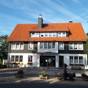
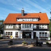
- Start: Kurpark
- Destination: Kurpark
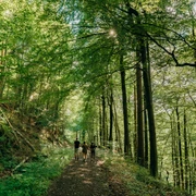
The 8 km long hike through Rappental to the Großer Rappenberg is a demanding but varied route, which is rewarded with a magnificent view over Benneckenstein and the mountain ranges behind with Brocken or Wurmberg.

Good to know
Best to visit
Directions
From the parking lot at Kurpark, the path leads us right at the roundabout onto the upper town up to Richard-Adam-Straße towards Hohegeiß.
Above Richard-Adam-Straße, we turn left at the next junction onto Hohler Fahrweg. At the hairpin turn on Hohler Fahrweg, continue to the right over a meadow path up to the Hochwald. On the concrete slab path (Kolonnenweg) we hike downhill to the left into Rappental. Then the route follows to the left over a newly constructed footbridge, past the Große Klippe, uphill through the nature reserve (path by the railing) to the upper path. To the left on the horizon, we can see the Brocken massif.
The path then continues to the state road, which we cross and continue at the school hostel.
After a short hiking break, the route goes left from the school hostel onto Rothesütter footpath, the old post road, continuing to Kälbertränke. At Kälbertränke, we turn left. Shortly before the next shelter, we turn left onto the grass path and continue hiking to the Graubergweg junction. Following the path to the left, we proceed to the next small crossroads. We then turn left at the edge of the forest to the barbecue area.
On Pfeiferberg shortly before the barbecue area, we enjoy a panoramic view of the town and the mountain massif with Brocken, Hohenkamm, and Wurmberg.
Following Pfeiferberg downhill towards Benneckenstein, after about 1 km we return to Benneckenstein. We pass the lower town and the pond dam until we finally reach our start/finish point Kurpark again.
Equipment
Sturdy footwear and rain gear are recommended. Don't forget your camera.
Directions & Parking facilities
You can reach Benneckenstein by car
- from Wernigerode via B244, turnoff Elbingerode B27 continue to the turnoff Königshütte B242 and in Tanne onto L98
- from Braunlage via B242, turnoff Tanne onto L98
- from Nordhausen via B4 to the turnoff L98 Benneckenstein
Parking is available at Kurpark.
You can reach the Harz town of Benneckenstein by bus operated by the Harzer Verkehrsbetriebe:
from Wernigerode with line 265
from Blankenburg with line 261
from Braunlage with line 264
or
by the Harzer Schmalspurbahn from Wernigerode or Nordhausen.
TIP:
With the Harzer UrlaubsTicket, you can travel free of charge throughout the entire Harz district.
HATIX – free use of public bus lines of the Harzer Verkehrsbetriebe, Q-Bus Nahverkehrsgesellschaft, Halberstädter Verkehrs-GmbH, as well as Verkehrsgesellschaft Südharz in the Harz district.
More information is available at: www.hatix.info
Additional information
Tourist Information Benneckenstein/Trautenstein
Bahnhofstraße 21b
38877 Stadt Oberharz am Brocken/OT Benneckenstein
benneckenstein@oberharzinfo.de
Tel.: 039457/2612
Literature
Unfortunately, there is no known literature.
Author
Sandra Marquardt
Organization
Tourismusbetrieb der Stadt Oberharz am Brocken
License (master data)
Safety guidelines
We have no known safety instructions.
Map
Hiking map - Stadt Oberharz am Brocken 1:25000; ISBN 978-3-86973-065-3
Nearby