Guided hike "Around Hohegeiß"
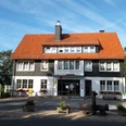
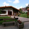
Meeting point: Tourist-Info Hohegeiß
Guided hike with marvellous views over the Hohegeiß mountains and mountain ranges. Passing interesting and historical points.
The exact route will be announced at the start of the hike.
The route is approx. 10 km long, 300 metres in altitude, takes approx. 3.5 hours.
Registration by the day before at the Hohegeiß Tourist Information Office on 05583-241 is desirable.
The hike is free of charge on presentation of the guest card.
Depending on the weather and snow conditions, curling is also offered as an alternative to the hike in January and February. Please enquire about this in advance at the Hohegeiß Tourist Information Centre.
Dates
Good to know
General information
Registration required
Author
Braunlage Tourismus Marketing GmbH
Elbingeröder Str. 17
38700 Braunlage
Organization
Braunlage Tourismus Marketing GmbH
License (master data)
Braunlage Tourismus Marketing GmbH

Nearby