- 5:05 h
- 16.92 km
- 375 m
- 489 m
- 264 m
- 593 m
- 329 m
- Start: Wieda Town Hall
- Destination: Walkenried
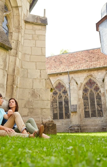
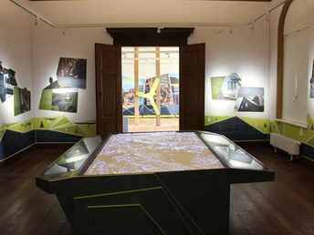
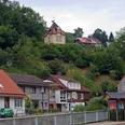
The towns Walkenried, Wieda and Zorge merged in 1972 to form a joint municipality. The 6th and final stage of the BaudenSteig passes through their area and repeatedly reveals the location of the towns at the former border to the GDR. A journey through time on foot. The start is in the Wieda river valley. The path leads via Helenenruh to Zorge. Mining of red iron ore and ironworks were the dominant economic factors for the residents until the end of the 19th century. The first two locomotives built in Germany were constructed in 1842 in Zorge for the Brunswick state railway. Today more is distilled here than built. The Hercynian Distilling Co. / Hammerschmiede in Zorge is the smallest spirits manufacture – not only in the Harz, but in all of central and northern Germany. Since 2002, single malt whisky has been distilled in the manufactory. The stage destination is the famous Walkenried Monastery. In 1127 Adelheid of Walkenried founded the third Cistercian monastery in today's Germany. The museum in Walkenried Monastery is considered the most innovative monastery museum in Europe. Visitors embark on a fascinating journey through time with the monks. After almost 100 kilometers, the time on the BaudenSteig is now over.
Good to know
Pavements
Best to visit
Directions
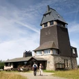
At the town hall (S) turn left into the Borntal and go straight uphill on a wide forest path. At the next T-junction turn right and ascend through beech forest to the Bremer Klippe (1). Follow the Kaiserweg to the Helenenruh junction (2). Turn right towards the shelter, slightly downhill. At the next junction turn left onto Wilhelm-Grote-Weg. At a radio mast leave the wide forest path and descend half-right. The path becomes narrower and sometimes steep downhill. (Caution when wet, possibly use sticks). Turn right to the Pferdchen viewpoint pavilion (3). It is located directly above Mittelzorge (Zorge is almost 7 km long!). At the end of the path you reach the Wiedaer Hüttenweg, immediately turn left onto the Grubenweg down into the village. In the valley turn left along the stream to the spa park. At the lower exit of the park stands the Zacharias-Koch-Haus (1681), now the tourist office. Cross the street, then climb stairs to the bell tower (4). Turn right onto a path, then continue on the "Langen Weg", a wide forest path, ignoring all side paths. At a large crossroads with an information pavilion, turn sharply right and follow the path into the Elsbach valley and further into the village. At the car park turn left to the Hammerschmiede (5). Along the Zorge on the spa promenade (formerly a railway embankment), past the children's farm with a large playground. Continue straight through the residential area until in Unterzorge turn right over a bridge. Cross the street, walk a few meters along the road towards Wieda. (6) Turn left onto the Eseltreiberweg into the forest. Last ascent to Hubertusplatz. Follow the Kaiserweg straight ahead to the main road. Here was the inner-German border. Now along the meadow (7) with small ponds on a dirt path at the edge of the forest. Soon the first houses of Walkenried come into view. Cross Ellricher Straße and follow the footpath to the right. At the next junction turn left into "Unter den Schießeisen". At house no. 7 a footpath directly along the Wieda through a wooded area. Over the bridge to the monastery car park and monastery (8). Here the Baudensteig ends. The town center and train station are not far away.
Equipment
Hiking boots, possibly sticks for the descent to Pferdchen; drinks and packed lunch for the way.
Directions & Parking facilities
A7, Seesen motorway junction; B243 to Bad Sachsa, then L601 to Wieda.
Wieda in the village
Walkenried train station, bus to Wieda, South Lower Saxony transport association
Public transport tips for day tour
Starting point in Wieda, stop In der Steier with line 472 from Bad Sachsa train station. On the way in Zorge (stops Am Kurpark, An der Lehne and Unterzorge) connection to line 470 to Walkenried train station. In Walkenried lines 470 and 472 operate.
Additional information
More information about the route >>here.
Or at the following addresses:
Tourist information of the municipality of Walkenried in Zorge, Am Kurpark 4, 37449 Zorge, Tel. 05586 96 2991, touristinfo@walkenried-tourismus.de,www.walkenried-tourismus.de
Harzer Sonnenseite, Guest Service Center, Ritscherstr. 4, 37431 Bad Lauterberg in the Harz, Tel. 05524 853190, info@harzer-sonnenseite.de
Author
Harzer Tourismusverband
Organization
Harz: Magische Gebirgswelt
License (master data)
Author´s Tip / Recommendation of the author
Points of interest along the way
Bremer Klippe (1), Pferdchen viewpoint pavilion (3), bell tower (4), Hammerschmiede (5), former border to the GDR, Walkenried floodplains (7), Walkenried Monastery with Cistercian Museum (8)
Safety guidelines
Possibly sticks for the descent to Pferdchen
Map
Nearby
