- 1:20 h
- 5.04 km
- 67 m
- 69 m
- 499 m
- 568 m
- 69 m
- Start: at the Waldschneise on the outskirts of Benneckenstein (direction Rothesütte)
- Destination: at the Waldschneise on the outskirts of Benneckenstein (direction Rothesütte)
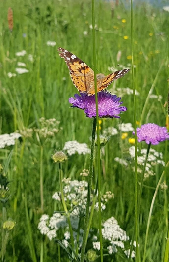
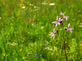
The Harz miners created a gem that has remained alive to this day: the mountain meadows. We marvel at the diversity and colorfulness of the meadows and should be aware that this meadow idyll is not a matter of course. Life of the Harz population in the Middle Ages and beyond was hard, arduous, and often not idyllic at all. Created through extensive use, the meadows depend on the continuation of traditional management. Without adapted agricultural use or care, the mountain meadows would disappear.
- Excerpt from the brochure "Bergwiesen Lehrpfad" LK Harz -
Good to know
Pavements
Best to visit
Directions
From the starting point "Waldschneise" in Benneckenstein:
► we go left past the forest stage to a fork in the road shortly before Hotel Harzhaus.
► Then continue right towards Ziegenkopfecho.
After enjoying a beautiful view here, the path leads us to Pfeiferberg.
► Going left it leads towards Benneckenstein to the "Unterstadt" parking lot. Now we take the path along the ski and toboggan slope towards Sophienhof on the Buchenberger Weg (1*) and make a small detour at the top into a forgotten and revived forest meadow. Then we return over Grauberg back to the starting point of our route.
(1*) Optionally you can extend the circular route by about 8 km and collect two stamps of the Harzer Wandernadel.
► Here, after about 3.1 km at the fork (Finnhütte) you would go straight towards Sophienhof.
► After about 750 m, keep left at another fork and after about 400 m turn left into the small forest path along the Moser pond towards Walzenhütte (HWN 50).
► From there you hike towards Buchberg to the stamp point (HWN 47) with a great view of the Brocken.
► Then you go back about 250 m and at the fork keep left towards Benneckenstein until you meet the Bergwiesen-Lehrpfad circular route.
Equipment
Sturdy footwear, functional clothing, backpack provisions, sun and rain protection are recommended.
Don't forget your camera and, if you want to extend the route, the stamp booklet of the Harzer Wandernadel.
Directions & Parking facilities
You can reach Benneckenstein by car
- from Wernigerode via B244, turnoff Elbingerode (B27) continue to turnoff Königshütte (B242) and in Tanne onto L98
- from Braunlage via B242, turnoff Tanne onto L98
- from Nordhausen via B4 to turnoff L98 Benneckenstein
Free parking is available at Waldschneise.
You can reach the Harz town Benneckenstein by bus from the Harzer Verkehrsbetriebe:
from Wernigerode direction
from Blankenburg direction
from Braunlage direction
or
by the Harzer Schmalspurbahn from Wernigerode or Nordhausen direction.
The INSA - your public transport route planner in Saxony-Anhalt >>
TIP:
With the Harzer UrlaubsTicket you are free to travel throughout the Harz district.
HATIX - the free use of public bus lines by Harzer Verkehrsbetriebe, Q-Bus Nahverkehrsgesellschaft, Halberstädter Verkehrs-GmbH, and Verkehrsgesellschaft Südharz in the Harz district. Now also free use in the districts of Goslar and Göttingen.
More information at: www.hatix.info
Additional information
The accompanying booklet for the Bergwiesen-Lehrpfad is available at the tourist information Benneckenstein and the LPV Harz office in Hasselfelde.
Literature
The accompanying booklet for the Bergwiesen-Lehrpfad is available at the tourist information Benneckenstein and the LPV Harz office in Hasselfelde.
Author
Mandy Leonhardt
Organization
Tourismusbetrieb der Stadt Oberharz am Brocken
License (master data)
Author´s Tip / Recommendation of the author
Along the way there are always beautiful views of the town of Benneckenstein and the mountain ranges behind it with the Brocken massif, the highest elevation in the Harz (1141 m). Numerous benches invite you to linger and enjoy.
The landscape on the Bergwiesen-Lehrpfad is particularly diverse and varied in the spring and summer months.
Optional see description:
You have the option to extend the circular route (not stroller-friendly) and collect two sought-after stamps of the Harzer Wandernadel.
No. 47 – Buchenberg - Oberharzblick
No. 50 - Walzenhütte
Safety guidelines
No safety instructions are known.
On some sections, short-term disruptions, detours, and closures due to forest changes and storm damage can occur at any time. Please check shortly before your hike. Current notices can be found here >
Map
Hiking map - Town of Oberharz am Brocken 1:25000; ISBN 978-3-86973-065-3
Nearby
