


- 6:00 h
- 56.85 km
- 1,428 m
- 1,428 m
- 528 m
- 1,142 m
- 614 m
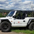
- Start: At Amtsweg / Parking lot, 38700 Braunlage. Starting also possible in Schierke.
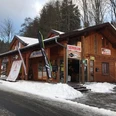
The mountain-valley route leads from Braunlage over the Wurmberg to the Brocken and on to the Ecker Reservoir. From there it goes past Torfhaus and the Achtermannshöhe (detour on foot) back to the starting point. The route includes steep climbs on asphalt and a rough descent from the Brocken on a slab path. In the area around the Brocken there are often many hikers, so start as early as possible.

Good to know
Pavements
Best to visit
Additional information
The Volksbank Arena Harz is also available on YouTube.
Author
Volksbank Arena Harz
Organization
Volksbank Arena Harz
License (master data)
Map
The Harz for Mountain Bikers
Through the extremely varied North German mid-range mountain landscape run 74 signposted mountain bike circular routes (total length 2,300 km), which are classified into three difficulty levels. Official map set “The Harz for Mountain Bikers.” Completely revised and expanded new edition. The new map set consists of a route book with detachable individual descriptions and detailed maps of the routes. There is also a topographic overview map (1:50,000) printed on weatherproof and durable POLYART material.
ISBN 978-3-935806-28-2
Price 16.80 €
Publisher map solutions, Karlsruhe 2017
Nearby


