B2 Achtermann Special


- 3:30 h
- 32.18 km
- 594 m
- 594 m
- 471 m
- 883 m
- 412 m
- Start: At Amtsweg / Parking lot, 38700 Braunlage
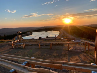
Larger and varied circular route without steep ascents. A detour to Achtermannshöhe (on foot) is recommended. At the Oderteich, which until 1898 was the largest reservoir in Germany, there is a beautiful root trail and swimming possibilities.

Good to know
Pavements
Best to visit
Additional information
The Volksbank Arena Harz is also available on YouTube.
Author
Volksbank Arena Harz
Organization
Harz: Magische Gebirgswelt
License (master data)
Map
The Harz for Mountain Bikers
Through the extremely varied northern German low mountain range landscape, there are 74 signposted mountain bike circular routes (total length 2,300 km), classified into three difficulty levels. Official map set "The Harz for Mountain Bikers". Completely revised and expanded new edition. The new map set consists of a route book with detachable individual descriptions and detailed maps of the routes. Additionally, there is a topographic overview map (1:50,000) printed on weatherproof and durable POLYART material.
ISBN 978-3-935806-28-2
Price 16.80 €
Publisher map solutions, Karlsruhe 2017
Nearby


Download GPX file