B3 Mountain and Silver route


- 4:30 h
- 37.58 km
- 902 m
- 894 m
- 378 m
- 711 m
- 333 m
- Start: At Amtsweg / parking lot, 38700 Braunlage. Entry also possible in Sankt Andreasberg.
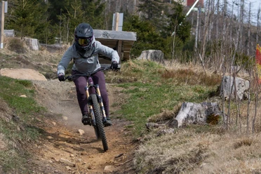
Large round route for cross-country riders with a high proportion of gravel and steep climbs. Three trail sections and passages through St. Andreasberg and Braunlage give the route a varied character.

Good to know
Pavements
Best to visit
Additional information
The Volksbank Arena Harz is also available on YouTube.
Author
Volksbank Arena Harz
Organization
Harz: Magische Gebirgswelt
License (master data)
Map
The Harz for mountain bikers
Through the extremely varied North German low mountain range landscape run 74 signposted mountain bike loop routes (total length 2,300 km), which are classified into three difficulty levels. Official map set "The Harz for mountain bikers." Completely revised and expanded new edition. The new map set consists of a tour book with detachable individual descriptions and detailed maps of the routes. There is also a topographic overview map (1:50,000) on weatherproof and durable POLYART material.
ISBN 978-3-935806-28-2
Price €16.80
Publisher map solutions, Karlsruhe 2017
Nearby


Download GPX file