- 2:25 h
- 8.68 km
- 100 m
- 78 m
- 580 m
- 638 m
- 58 m
- Start: Forest parking lot "Bechlerstein" at the Heimathütte near Hohegeiß
- Destination: same as the starting point
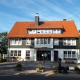
The route begins at the forest parking lot "Heimathütte" at Bechlerstein. At the trail sign, the circular hiking begins, first leading right uphill on Ebersbergstraße, which is initially only paved. Before it then runs almost flat along the north side of the Ebersberg, you get a first wide view of the highest Harz mountains Brocken, Wurmberg, and Achtermann.
After a few meters, we then reach a "Dennerttanne," an information board explaining the location of the former Ebersberg ski jump at this spot. At the following fork, the "Old Post Road" branches downhill to Braunlage. But we continue to the left on the flat Ebersbergstraße towards the "Zero Point." We reach this after another 2 km. There is a shelter a few meters off in the forest that invites you to rest. The "Zero Point" is a historic survey point, located at a hiking parking lot on the Braunlage-Zorge road and marks our westernmost point of the route.
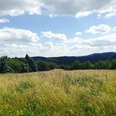
At the large spiderweb of paths, we now follow the "Horizontal Trail" southward on the slope of the Ebersberg, gently rising. We soon reach the sunny side of the mountain, the path becomes flat again and now winds in a serpentine manner for the next 2 km to the "Hahnestein," where there is also a stamp station of the Harzer Wandernadel. This section offers wide views of the hills and valleys located to the south.
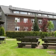
It then goes slightly downhill again to the "Willibald-Ihmann-Köte" (shelter). There we turn left and follow the road uphill on a direct path back to the starting point at the grill hut at the Bechlerstein memorial.
Good to know
Pavements
Best to visit
Directions
Equipment
Since the route is also classified as stroller-friendly, light hiking gear is sufficient.
The path can be used as a winter hiking trail and is therefore accessible year-round.
Directions & Parking facilities
Additional information
On the route, you pass several shelters and huts where you can take a break. Some information boards ("Dennerttannen") describe historic places and monuments.
At Hahnstein was stamp station #206 of the Harzer Wandernadel.
Author
Jörg Kühnhold
Organization
Harz: Magische Gebirgswelt
License (master data)
Author´s Tip / Recommendation of the author
Safety guidelines
Nearby


