Von-Langen circular route

- 1:25 h
- 5.26 km
- 76 m
- 74 m
- 533 m
- 590 m
- 57 m
- Start: At the Steinsklippe in the upper part of the Kurpark of Braunlage
- Destination: like the starting point
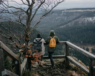
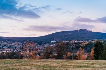
Those who have reached our starting point of the circular route, the Steinsklippe in the upper Kurpark of Braunlage, are offered a great view over the roofs and surroundings of Braunlage. To the north, you can see the spire of the church tower, the striking summit of the Achtermann, and next to it, the Wurmberg stands proudly. Below us, the Bode river, the lifeline of the town, can be heard, and you can look out over the mountain and ski training meadows of Braunlage.
The work of the path's namesake, the head huntsman Johann Georg von Langen, is described on the granite monument: among other things, he was a pioneer of sustainability in forestry, introduced the potato in 1748 to alleviate famine in the town, founded the Fürstenberg porcelain manufactory, and set forestry standards for several years in Denmark and Norway.
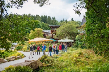
We begin the route with a short passage through the Berggarten, where special trees and shrubs characterize the park. The reconstructed charcoal burner’s hut ("Köte") hints at the long period when Braunlage, as a smelter town, used charcoal produced by charcoal burners to process Harz ore into metal products.
After leaving the Kurpark through a turnstile in the fence, the path leads through areas affected by bark beetle infestation and forest renewal. After several forks, we reach the "Lange Bruch" and shortly thereafter the Bremke stream, which formed the inner-German border until reunification. Given today's near-natural appearance, it is hard to imagine that a few decades ago, a large metal fence with insidious deadly devices cut across this landscape. Therefore, along the entire former border course now runs the longest European nature reserve, the "Green Belt."
After crossing the small wooden bridge over the Bremke, we are in Saxony-Anhalt. From here, the Harz Border Trail can be continued. However, we go back over the bridge and keep right of the designated nature reserve "Langes Bruch." With some luck, you can discover special plants such as club moss or rare animals like the blue-winged damselfly or the black stork here. The forest provides a sign indicating forest restructuring in this area.
The path ascends slightly past the marshy terrain, finally reaching a small climb shortly before the town's edge, which leads back to the Kurpark of Braunlage.

Good to know
Pavements
Best to visit
Directions
The circular route is marked throughout its entire length with its own symbol, the silhouette of Georg von Langen's head. Therefore, no further description is necessary.
At the start area and at the turning point at the "Green Belt," there are also information boards about the path and the person of the name giver.
Equipment
Directions & Parking facilities
Additional information
Informative links:
The path's namesake is Johann Georg von Langen
The path connects to the Green Belt / Harz Border Trail
Author
Jörg Kühnhold
Organization
Harz: Magische Gebirgswelt
License (master data)
Author´s Tip / Recommendation of the author
Beautiful view from the "Steinsklippe" over Braunlage.
Insights into forest restructuring and renewal.
Near-natural swamp landscape "Langes Bruch," as well as the longest nature reserve "Green Belt."
Tree-rich park landscape in the upper Braunlage Kurpark.
Recognition of the work of Johann Georg von Langen.
Safety guidelines
Caution is advised in the cliff area at the starting point, especially for children (risk of falling).
At the turning point of the route, the path crosses a wooden bridge. There is a risk of slipping here. This bridge is also not barrier-free!
Nearby


Download GPX file