- 3:40 h
- 12.16 km
- 330 m
- 330 m
- 248 m
- 417 m
- 169 m
- Start: Parking lot under the B243 bridge at the Steinkirche in Scharzfeld
- Destination: Parking lot under the B243 bridge at the Steinkirche in Scharzfeld
You walk through forest, geology, Ice Age and Stone Age, along cliffs, encounter cave bears and can still hear the echo of French artillery. It is recommended to hike the route clockwise, so the dining opportunities come when you have built up a good appetite.
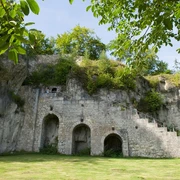
From the start, you go up to the Steinkirche, a natural cave crevice where hunters and gatherers already sought shelter and lit campfires at the end of the last ice age. In the Middle Ages, it was expanded into a church space with a pulpit, baptismal font, and crypt. The further path leads over species-rich semi-dry grasslands to the Ritterstein, where the traditional Easter fire is lit with a wide view over the southern Harz. The path goes down into the Bremke valley where a campsite, outdoor pool, restaurant, and above that a forest playground await. Then it steadily goes up through deciduous forest to the Rottstein cliffs. Next, it continues through deciduous forest on the ridge clockwise around the source areas of the streams in the Rott and Hasenwinkelbach up to the Frauenstein. In the undergrowth lie artillery positions of French troops from 15.9.1761, from which—during the Seven Years' War—the Scharzfels castle was heavily shelled.
The Scharzfels castle, built around the year 1000, had great territorial historical significance. Information boards reveal the history and former buildings. After refreshment in the “Schlossgaststätte” (closed Mon, Tue and in winter Wed), the path goes down into the Hasenwinkeltal to ascend on the other side, where a tour through the Einhornhöhle is a “must” for every visitor to the southern Harz. The “Haus Einhorn” invites you in before or after visiting the cave. The cave is a site of long-lasting scientific research, spanning from the legendary unicorn through the ice ages and cave bears to the Neanderthal and early researchers like Leibniz, Goethe, or Virchow.
Along the Kaiserklippe and other dolomite rocks, the path leads westward and descends along the meadow edge with beautiful views over the wide Harz foreland into the Rott, then ascends further onto the Schulberg, where rocks and shelters show where people lived in the middle Stone Age. The last section of the path goes through the Bremke valley back to the campsite and from there up to the familiar Steinberg with the Ritterstein. “How wonderfully quiet it is in Scharzfeld, far from the clatter of cars.” So wrote Hermann Löns around 1910 as he rested at the Ritterstein. And today? Only a few steps remain to the start point.
Good to know
Pavements
Best to visit
Directions & Parking facilities
Additional information
Author
Firouz Vladi
Organization
Harz: Magische Gebirgswelt
License (master data)
Map
Nearby


