- 5:50 h
- 20.67 km
- 368 m
- 368 m
- 148 m
- 293 m
- 145 m
- Start: Parking lot of the ALOHA swimming pool in Osterode
- Destination: Parking lot of the ALOHA swimming pool in Osterode
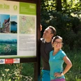
For this circular route, the time of the golden autumn foliage and the time of the spring flowers is the most beautiful due to the deciduous forest in the karst beech forests. After leaving the town of Osterode heading south, the Karst Hiking Trail leads through the Osterode city forest with the King George Pavilion and old hollow paths to the Osterode limestone mountains.
Soon you will reach the Pipinsburg, one of the most impressive prehistoric monuments of the Harz region and at the same time one of the most important fortifications of the southern Lower Saxony mountainous area. These are now only recognizable as grass-covered ramparts. They lie on the mountain spur that extends far into the Söse valley, whose sharp steep drop to the north and east was formed by the dissolution undercutting of the Söse river. Gypsum mining has greatly changed the original image of the landscape in this area. A farm track leads down to the village of Förste. Here you will first encounter the Grafenquelle, where mineral spring water is bottled.
Immediately after the large spring pond, turn left into the village of Förste with numerous other, partly saline springs, and then back out into the fields. Here you will be greeted by the 262 m high Lichtenstein. You enter a karst beech forest. Under the tall leafy canopies, many valuable ground plants grow on the forest floor, which in spring turn the forest floor into a blooming carpet. Passing the closed entrance to the Lichtenstein cave (natural/cultural monument), after about 300 m you ascend to the left into the forest. Very deep sinkholes accompany you on both sides during the ascent. The Karst Hiking Trail then leads to the summit made of Lower Bundsandstein. There, you can use the slope in the beech forest below the Lichtenstein castle ruins for a rest or look for the occasionally still found wall remains and castle ramparts.
Passing the sinkholes of Farmer’s Mountain, a quarry lies to the left. Here, the thickness of the gypsum exceeds 60 m. Small caves were occasionally cut into but disappeared due to mining activities. After carefully crossing the B 241 past the Mammutstein, the route follows the seven chambers sinkhole series to Ührde. Here there are options to stop at the Landgasthof Sindram or the village café. Passing the Härkenstein quarry (gypsum, dolomite) through an attractive forest landscape with many impressive sinkholes, the trail later ascends the “Field Marshal’s Hill” with a magnificent view of the stepped landscape of the South Harz. Heading northwards down again, the route leads back over the former Osterode training area to the starting point at the ALOHA.

Good to know
Pavements
Best to visit
Directions & Parking facilities
Parking lot of the ALOHA swimming pool in Osterode
Additional information
Author
Firouz Vladi
Organization
Harz: Magische Gebirgswelt
License (master data)
Map
Nearby