St. Andreasberg Elevated Hiking Trail

- 4:50 h
- 16.38 km
- 418 m
- 417 m
- 442 m
- 725 m
- 283 m
- Start: At "Jordanshöhe" at the parking lot there.
- Destination: like starting point
The starting point is located on Jordanshöhe in the north above St. Andreasberg. Those who do not want to drive to the parking lot there by car start from the spa house in town and follow the hiking marker 15D, ascending about 1 km to Jordanshöhe.
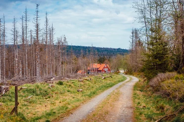
First, we walk the dead-end road westward, cross the state road, and head towards the farm. The path passes the farmstead and offers a great view over St. Andreasberg and the West Harz (view in good weather) up to the Hoher Meissner.
The path then leads us through the St. Andreasberg meadows. At their end, we turn left towards St. Andreasberg, crossing the Sperrlutter, then along the Gerenner Weg with a nice view over the street "Bäckerhügel" into the built-up area. We proceed via Mühlenstraße to Galgenberg. We circle it and then end up on the street "Auf der Höhe." A short detour to the summit is worthwhile on the left because here you have a fantastic view of the Harz mountains and the Acker mountain range.
At "Schwalbenherd" we turn right and cross the old railway bridge on the "Schiefe Halbe" below Glockenberg until we reach a larger crossroads.
Those who choose the shortened route turn left here via hiking trail marked 28B above the Wäschegrund back to St. Andreasberg.
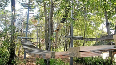
Otherwise, we turn right and go to the lowest point of the hike, the district "Silberhütte." Then we walk a bit through the "Wäschegrund" and leave the road after about 500 meters on the right and are now ascending. The next place to stop is the mountain inn "Matthias Baude" on Matthias Schmidt Berg.
We now continue towards St. Andreasberg and then turn left from the main path.
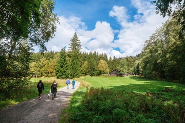
Here, we walk through beech forests, pass old galleries, and then the mine "Roten Bären." Now it goes uphill again, and in front of the mountain meadows of St. Andreasberg, with a beautiful view of the old mining town, we keep left and follow the driveway. We cross the road to Braunlage and keep slightly to the left. At the larger hiking crossroads, we follow the "Harzer Hexenstieg" back to Jordanshöhe.

Good to know
Pavements
Best to visit
Directions
Equipment
Directions & Parking facilities
Follow the access road for about 400 m to the signposted parking lot "Jordanshöhe".
Alternatively, you can also park directly on the state road (at the rock path). The route can also be started/ended there.
The elevated circular trail crosses the state road towards Sonnenberg shortly after the start at Jordanshöhe. There is a bus stop where two lines stop, which, besides the short trip to/from St. Andreasberg, also offer connections to/from other Harz towns:
- Line 820 to/from Braunlage and Bad Harzburg (train station)
- Line 840 to/from Altenau and Clausthal-Zellerfeld (connection to Goslar)
At the central bus station St. Andreasberg, line 450 also runs to/from Bad Lauterberg and Herzberg (train station)
Additional information
On this long circular route, you can hike and experience the sights of St. Andreasberg with detours:
Author
Jörg Kühnhold
Organization
Harz: Magische Gebirgswelt
License (master data)
Author´s Tip / Recommendation of the author
A path that circles St. Andreasberg and makes the special features of the old mountain town tangible:
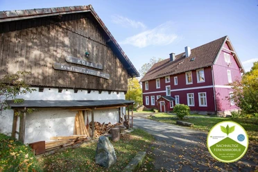
- Old mining
- Upper Harz mountain meadows
- Panoramic views and wide vistas over the Harz mountains
- Sports and adventure mountain "Matthias-Schmidt-Berg"
Safety guidelines
Nearby


Download GPX file