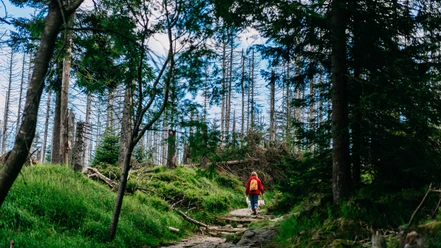
Achtermann trail


- 1:55 h
- 7.52 km
- 177 m
- 177 m
- 768 m
- 872 m
- 104 m
- Start: Königskrug (trail sign located behind the Königskrug inn directly on the B4)
- Destination: Königskrug (trail sign located behind the Königskrug inn directly on the B4)
Connections to the Rote-Bruch trail and the Braunlage trail (circuit 3.1 mi and 6.2 mi)
Elevation: 720 to 880 m above sea level

Good to know
Best to visit
suitable
Depends on weather
Additional information
Tourist Information Braunlage
Elbingeröder Straße 17
38700 Braunlage
Tel. 05520 93070
tourist-info@braunlage.de
www.braunlage.de
Author
Harzer Tourismusverband
Organization
Harz: Magische Gebirgswelt
License (master data)

Nearby


Download GPX file